Morro da Igreja
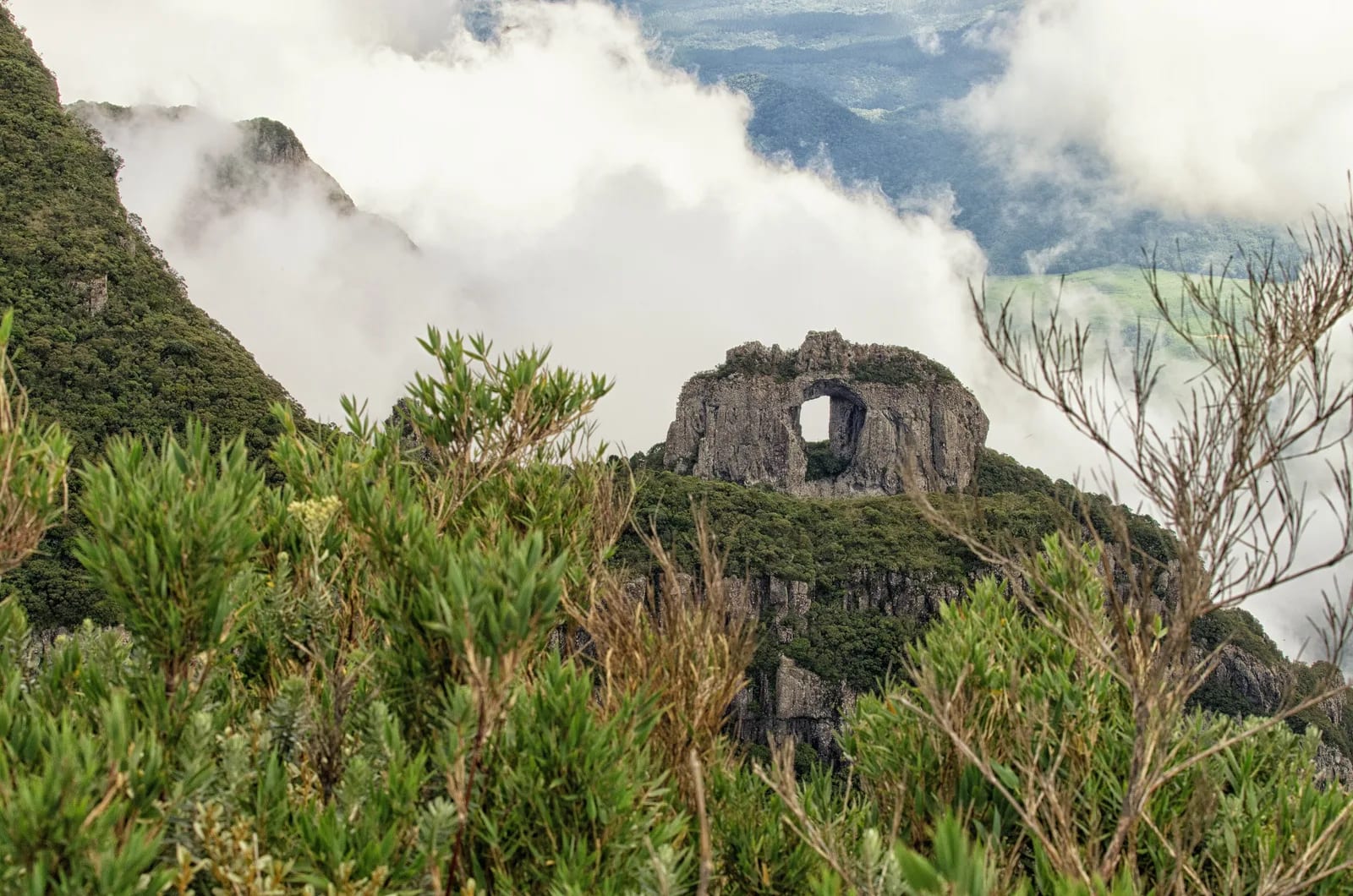
At Parque Nacional de São Joaquim, at Serra Catarinense, with a visit organized from Urubici and overlooking Pedra Furada.
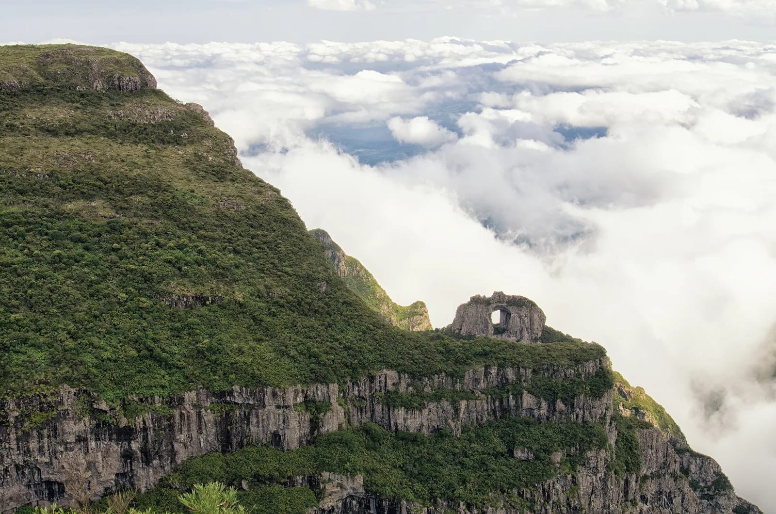
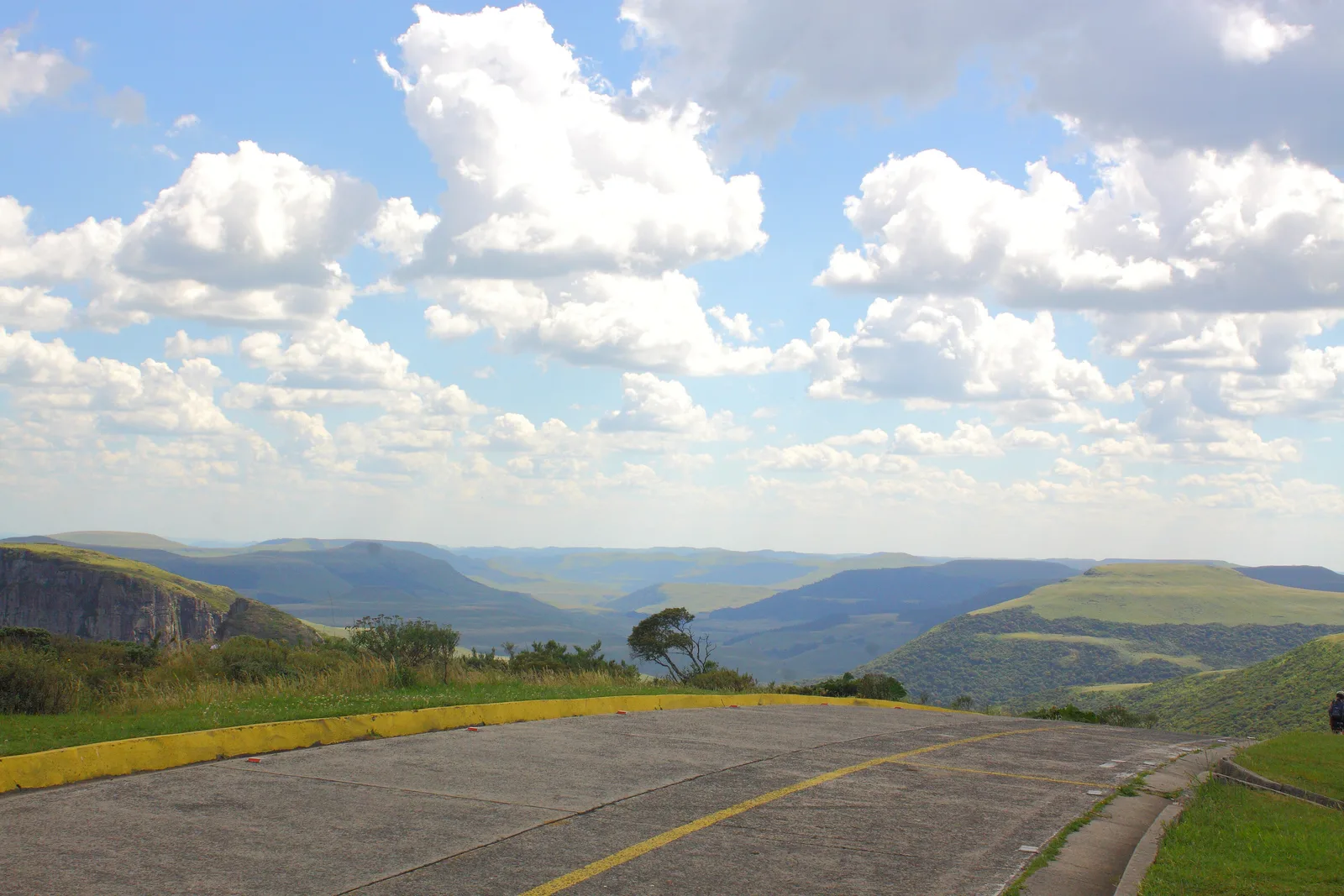
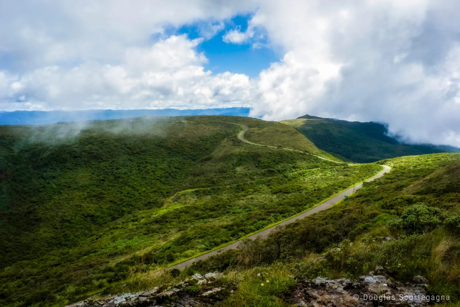
A Serra Catarinense lookout at 1,822 meters (5,978 ft), where Pedra Furada stands out above highland grasslands and escarpments. The experience brings together a vast horizon, mountain cold and one of Santa Catarina’s most recognizable landscapes.
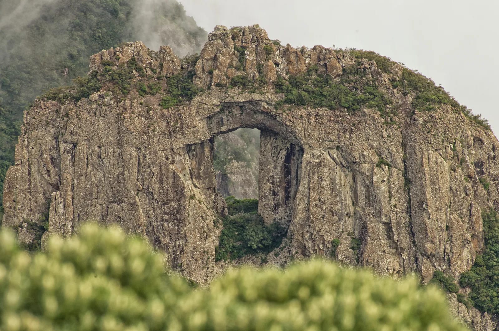
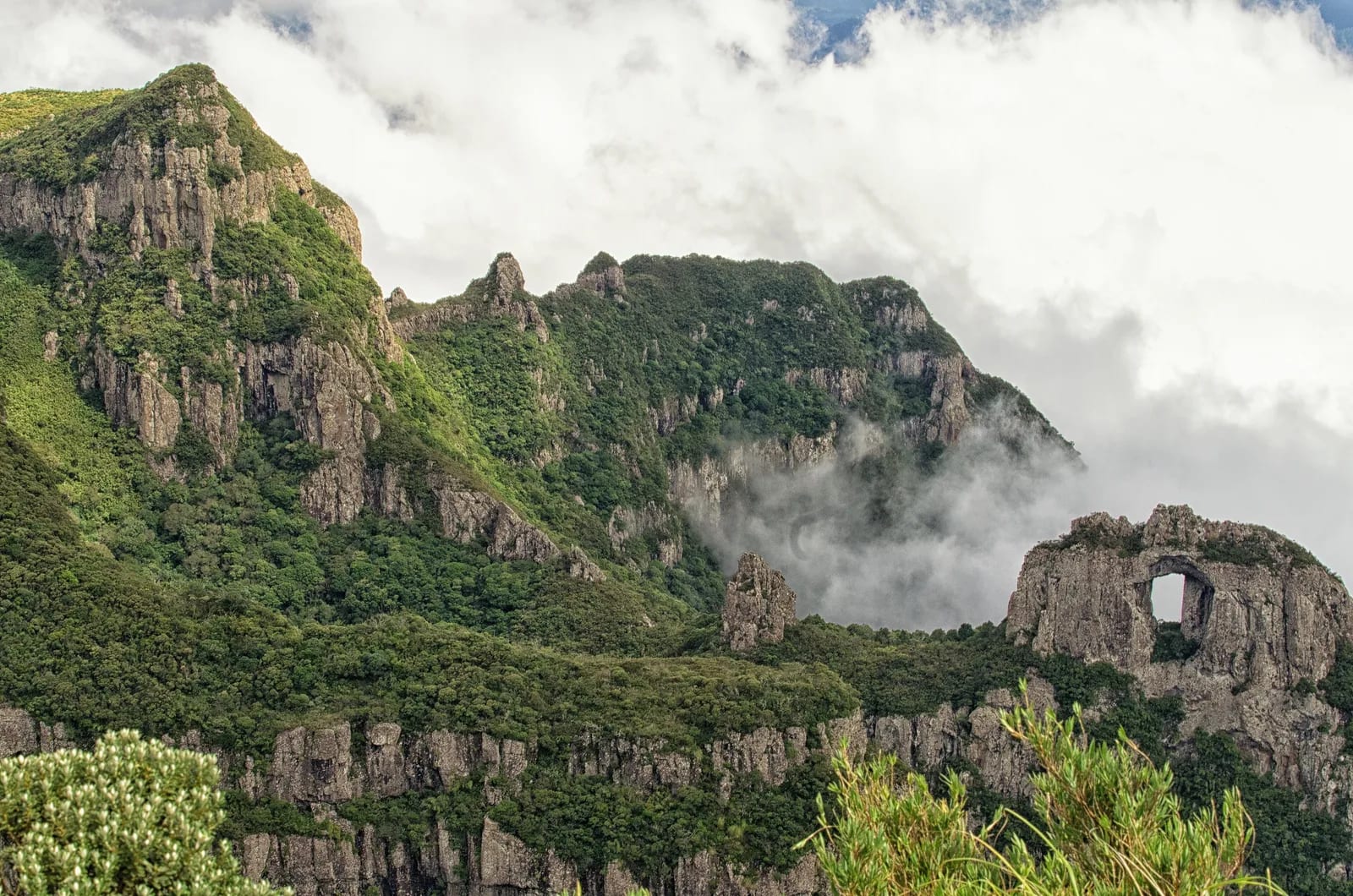
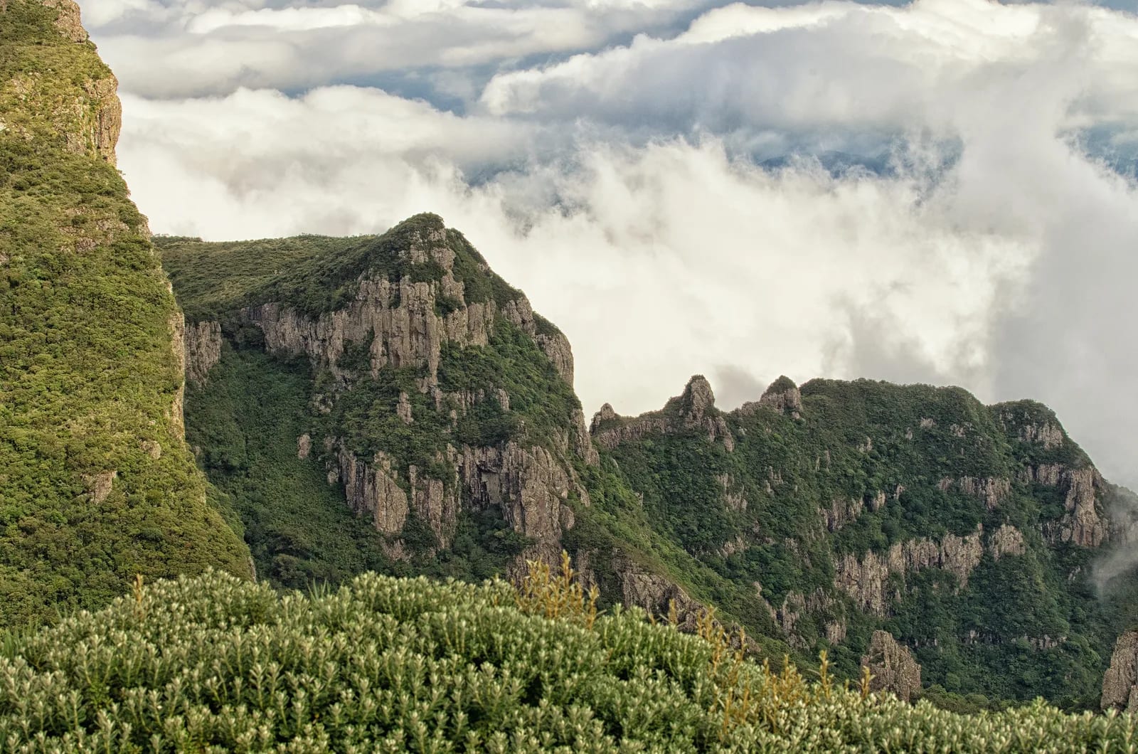
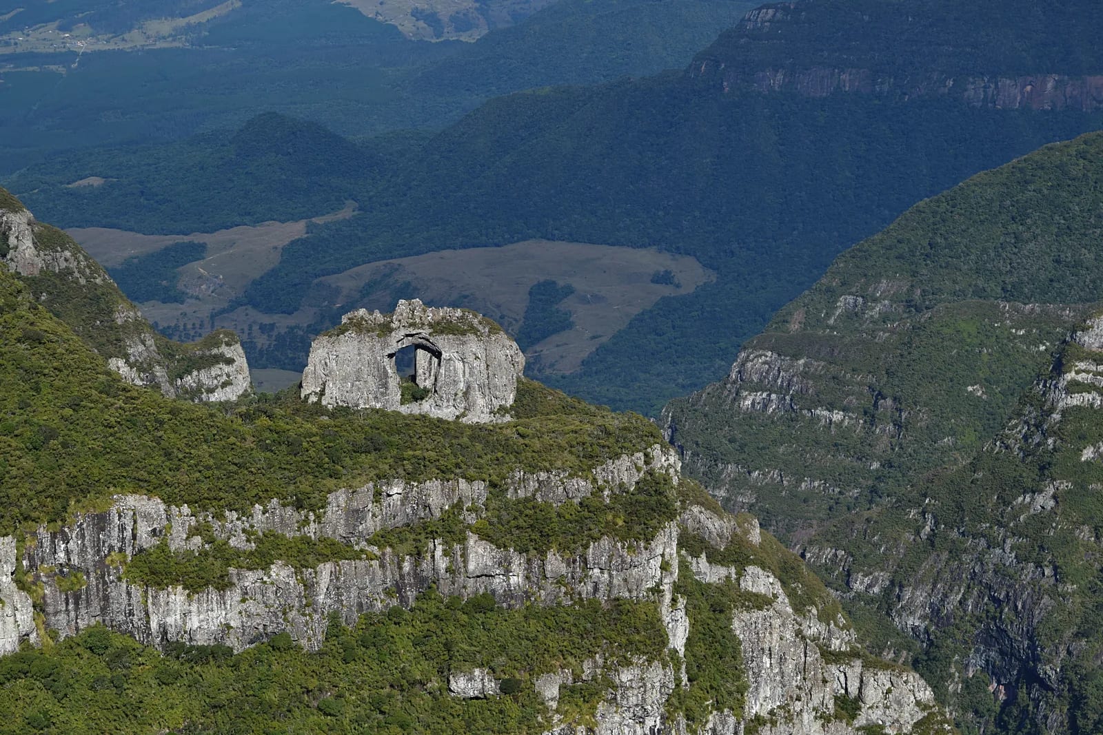
High in the Serra Catarinense, a keen wind crosses high-altitude grasslands, rocky outcrops and remnants of araucaria forest. Morro da Igreja is the classic lookout in Parque Nacional de São Joaquim for viewing Pedra Furada, a rock window cut into the Serra Geral landscape. Frost and, occasionally, snow lend the route a highland atmosphere that challenges the usual idea of Brazil as only tropical.
🤔 Why does it matter?
This attraction gathers the park’s highland scenery and protected environmental diversity in a single viewing point. It is a contemplative visit that helps reveal the scale of the Serra Geral and the importance of conserving southern grasslands and forests.
📍 What to see
- Pedra Furada, natural arch observed from the viewpoint
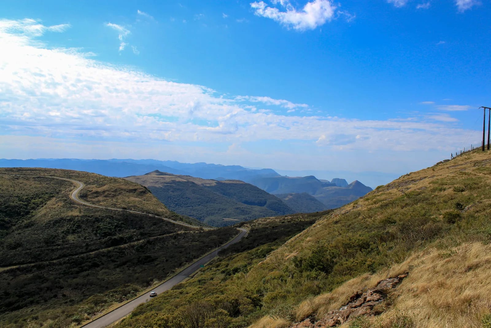
- Scarps and valleys of Serra Geral
- High altitude fields, exposed rocks and mountain vegetation
- Parque Nacional de São Joaquim Overview
🎒 Things to do
- Admire the landscape at the authorized viewpoint
- Photographing the rock formation and changing light
- Take the short walk from the parking lot to the observation point
- Combine the climb with other attractions of Urubici
✨ Recommended experiences
- Half-day itinerary: collect your ticket at the park headquarters at Urubici, go up in the reserved shift and dedicate time to the viewpoint and Pedra Furada.
- Winter itinerary: plan your visit for an open weather morning, bring technical clothing and complete the day with the mountain cuisine of Urubici.
- Photographic itinerary: follow the forecast, choose a shift with a greater chance of visibility and maintain a margin of time for possible access restrictions.
🍽️ Local cuisine
🎶 Soundtrack
- Nas Manhãs do Sul do Mundo — Expresso Rural
🎭 Local culture
🌿 Nature nearby
🌎 Biomes
🏞️ Natural features
🐾 Wildlife you may spot
🌱 Plants you may see
📅 Best time to visit
From April to November, the mountains offer different views of the landscape; For those looking for cold, frost and winter atmosphere, June to August is the most popular period, always subject to the forecast and access permission.
- ✅ Best time:
- June to August, for the most intense cold, frost and the rare possibility of snow.
- 🟡 Shoulder season:
- April and May, with moderate cold, and September to November, when temperatures tend to be milder and the region's waterfalls gain volume.
- 🔴 Less recommended:
- Days of dense fog, rain, ice on the runway or operational restrictions, regardless of the month.
- 📝 Notes:
- Road visibility and safety weigh more than the calendar; confirm weather conditions and scheduled shift before heading out.
🧭 Getting there
🏙️ Base city: Urubici
✈️ Airport: Aeroporto Internacional de Florianópolis Hercílio Luz (FLN)
- Arrive at Urubici by road and collect your physical ticket at the Parque Nacional de São Joaquim headquarters in advance.
- With your reservation confirmed, follow the state highway towards the park and the access road to Morro da Igreja, following the instructions at the entrance.
- Advance booking is mandatory, made per vehicle and valid for a single date and time slot.
🚗 Local transportation
- Own or rented car offers the most practical alternative to combine ticket collection and the climb.
- Hire a transfer or local driver if you don't want to drive in mountains and in varying weather conditions.
- The visit includes a short, uneven walk between the parking lot and the viewpoint.
ℹ️ Practical information
- 🏗️ Infrastructure:
- Structured in the base city and controlled in the attraction
- 🏨 Where to stay:
- Urubici concentrates guesthouses, rural hotels and cabins for different travel profiles.
- 🍴 Food:
- Restaurants and cafes are mainly concentrated in Urubici; Bring a snack and water for the duration of your visit.
- 🧭 Guides and agencies:
- There are local drivers and operators for transfers and mountain routes; confirm accreditation and conditions in advance.
- 📶 Internet and signal:
- Connectivity may fluctuate on the mountain; do not depend on your cell phone to receive essential instructions during the climb.
- 💰 Estimated cost:
- Entry is free. The budget varies mainly depending on transportation, accommodation, food and possible hiring of a transfer or driver.
- 📝 Notes:
- The park requires advance booking and in-person ticket collection in Urubici; pets and drones are not permitted.
♿ Accessibility
Level: consult local operators
The vehicle arrives close to the observation point, but uneven ground, wind and exposed terrain may limit the autonomy of some people.
- Confirm route and lookout conditions with the park before travel.
- Consider a companion for those who need support on uneven terrain.
- Prepare for low temperatures and gusty winds.
⚠️ Safety
🚨 Real risks
- Fog that drastically reduces visibility
- Strong wind and low thermal sensation
- Ice and adverse conditions on the mountain road
- Canyon edge and marked areas that should not be crossed
✅ Recommended care
- Monitor the weather forecast and road conditions on the day of your visit.
- Wear good-fitting footwear and layered clothing, including hand and head protection.
- Respect barriers, signage and instructions from park agents.
- Bring water, snacks and the necessary documents to collect your ticket.
⛔ When to avoid: Avoid climbing without an appointment, under intense fog, during a weather alert, with ice on the trail or when the park restricts visitors.
📝 Checklist — what to bring
- Proof of appointment and identification document
- Sunscreen and protection against ultraviolet radiation
- Layered outerwear, gloves and hat
- Footwear with non-slip soles
- Water and energy snack
- Waterproof bag for electronics and documents
✈️ Travel tips
- Set aside two or three days to integrate the viewpoint with waterfalls and other scenes in Serra Catarinense.
- Choose the visit time according to the forecast and maintain flexibility in the itinerary.
- Don't leave ticket collection until the last minute; it occurs before the ascent.
- Do not take drones or pets, as both are prohibited for visits.
💡 Fun facts
- According to the Urubici municipal government, Pedra Furada measures about 30 meters (98 ft) in circumference.
- From the parking lot, the approach to the canyon rim for viewing it is approximately 20 meters (66 ft).
- On exceptionally clear days, the municipal government says it is possible to see the sea more than 100 kilometers (62 mi) away.
🤔 Did you know?
- The main visiting activity at Parque Nacional de São Joaquim is contemplation at the Morro da Igreja e Pedra Furada viewpoint.
- Between the Morro da Igreja and the Campos de Santa Bárbara, watercourses originate that contribute to the Pelotas and Canoas river basins.
- The park's grassland formations and high-altitude rocky outcrops concentrate high levels of endemism.
📜 History and context
The landscape visited is part of the Parque Nacional de São Joaquim, created in 1961 to protect environments of the Planalto Sul-Catarinense and the slope of the Serra Geral. The summit is also home to Destacamento de Controle do Espaço Aéreo do Morro da Igreja, a presence that has marked the area's infrastructure over time.
🌍 Global importance
The park is the core area of the the Atlantic Forest Biosphere Reserve and preserves a mosaic of forests, fields and high-altitude environments. Its remnants of Brazilian pine forest and habitats of endangered species give it relevance that goes beyond scenic tourism.
🗺️ Quick map (orientation)
📌 Main base: Urubici, where the headquarters of Parque Nacional de São Joaquim is located and where the logistics of the visit depart from.
🧭 Landmarks
📍 Nearby places
Small discoveries
- Santa Catarina
- Federative Unit: Santa Catarina, in the Southern Region of Brazil.
- Campos de altitude
- High altitude field formations, with grasses and herbs adapted to the cold.
- Araucárias
- Araucaria angustifolia, Brazilian pine, symbol of the South.
- Parque Nacional de São Joaquim
- Federal conservation unit managed by ICMBio.
- Serra Geral
- Set of cliffs and canyons that mark the limit between plateau and coast.
- Entrevero
- Typical Santa Catarina stew of meats and vegetables, served steaming.
- Pinhão
- Edible seed from Brazilian pine, base for winter dishes.
- Quentão
- Warm winter drink made with spices and cachaça or wine.
- INMET
- National Institute of Meteorology, responsible for official forecasts and warnings.
- FLN
- International Airport Hercílio Luz, code IATA FLN.
- SC-110
- State highway providing access to the top of the mountains, with steep sections.
- Proteção UV
- Filter against ultraviolet radiation, even in cold weather.
- Aeronáutica
- Força Aérea Brasileira, responsible for air defense and airspace control.
- Mata Atlântica
- Biome of high biodiversity that includes Serra do Mar and southern plateaus.